


PRECINCT WASHINGTON EAST, Holmes County, Ohio
About
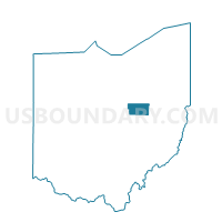
Outline

Summary
| Unique Area Identifier | 647990 |
| Name | PRECINCT WASHINGTON EAST |
| County | Holmes County |
| State | Ohio |
| Area (square miles) | 11.09 |
| Land Area (square miles) | 10.84 |
| Water Area (square miles) | 0.25 |
| % of Land Area | 97.73 |
| % of Water Area | 2.27 |
| Latitude of the Internal Point | 40.63144290 |
| Longtitude of the Internal Point | -82.12876010 |
Maps


Graphs
Select a template below for downloading or customizing gragh for PRECINCT WASHINGTON EAST, Holmes County, Ohio


Neighbors
Neighoring Voting District (by Name) Neighboring Voting District on the Map
- Voting District CLINTON TWP 4, Wayne County, OH
- LAKE TWP Voting District, Ashland County, OH
- PRECINCT KNOX TOWNSHIP, Holmes County, OH
- PRECINCT RIPLEY TOWNSHIP, Holmes County, OH
- PRECINCT WASHINGTON WEST, Holmes County, OH
Top 10 Neighboring County Subdivision (by Population) Neighboring County Subdivision on the Map
- Clinton township, Wayne County, OH (3,081)
- Ripley township, Holmes County, OH (2,338)
- Washington township, Holmes County, OH (1,624)
- Knox township, Holmes County, OH (1,117)
- Lake township, Ashland County, OH (690)
Top 10 Neighboring Place (by Population) Neighboring Place on the Map
Top 10 Neighboring Unified School District (by Population) Neighboring Unified School District on the Map
- West Holmes Local School District, OH (18,225)
- Loudonville-Perrysville Exempted Village School District, OH (7,679)
Top 10 Neighboring State Legislative District Lower Chamber (by Population) Neighboring State Legislative District Lower Chamber on the Map
Top 10 Neighboring State Legislative District Upper Chamber (by Population) Neighboring State Legislative District Upper Chamber on the Map
Top 10 Neighboring 111th Congressional District (by Population) Neighboring 111th Congressional District on the Map
Top 10 Neighboring Census Tract (by Population) Neighboring Census Tract on the Map
- Census Tract 9765, Holmes County, OH (5,189)
- Census Tract 9709, Ashland County, OH (4,943)
- Census Tract 19, Wayne County, OH (3,081)